Thailand Tourist Map 2026: Regions, Cities, Islands & Free PDF
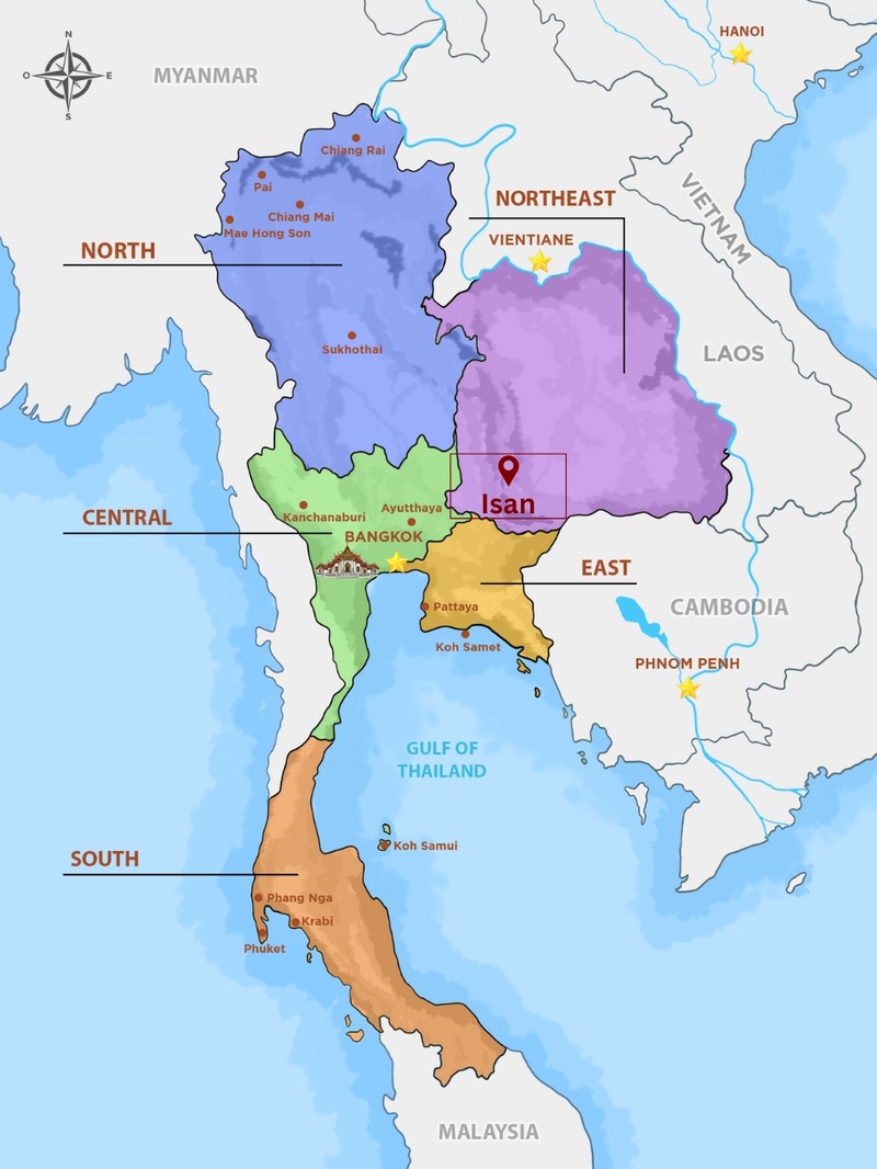
A Thailand tourist map is easiest to read in five travel regions: the mountainous north around Chiang Mai, the central plains with Bangkok and Ayutthaya, the Isan plateau in the northeast, the east coast around Pattaya, and the southern peninsula, with Phuket and Krabi on the Andaman Sea and Koh Samui in the Gulf of Thailand.
Below you will find a map of each region, travel times between the main hubs, the best season for each coast, and a free PDF of the Thailand tourist map to download and print.
Written by Thom DOAN (Travel Consultant Manager & Director)
Updated on Sep 23, 2026
0 comment
Thom DOAN leads the travel consulting team at Kampá Tour and serves as the agency's director. She works with travellers in both French and English, and her career has taken her across multiple countries in Asia.
On this blog she writes about the destinations she knows first-hand, mostly in Vietnam and Cambodia: what a place is actually like, who it suits, and the practical details that decide whether a trip works. If you have a question about anything she covers here, leave it in the comments and she will answer you directly.
Visualizing the map: Think of Thailand as the shape of an elephant's head. The North is the head, Bangkok sits at the mouth, and the long southern peninsula is the trunk.
Full name: Kingdom of Thailand (Thai: ราชอาณาจักรไทย, Ratcha-anachak Thai).
Capital: Bangkok, known in Thai as Krung Thep Maha Nakhon.
Currency: Thai baht (฿, THB).
Location: the center of mainland Southeast Asia, with the Andaman Sea on the west coast and the Gulf of Thailand on the east.
Borders: Myanmar, Laos, Cambodia and Malaysia. Thailand has no land border with Vietnam.
Area: about 513,120 km², divided into 76 provinces plus Bangkok.
Landscape: mountains in the north and west, the Khorat Plateau (Isan) in the northeast, a central rice plain around Bangkok, and a long southern peninsula with islands on both coasts.
Main river: the Chao Phraya, whose basin covers roughly 30% of the country and feeds the central plain.
Highest point: Doi Inthanon, in Chiang Mai province.
Most first-time visitors picture Thailand's islands, but the map shows how much sits inland: ruined royal capitals on the central plain, temples and hill villages in the north, and a northeast that few international travelers reach. Thailand is often called "the Land of Smiles", and the welcome is much the same from one region to the next.
🗺️ Free Thailand Tourist Map PDF (Download & Print)
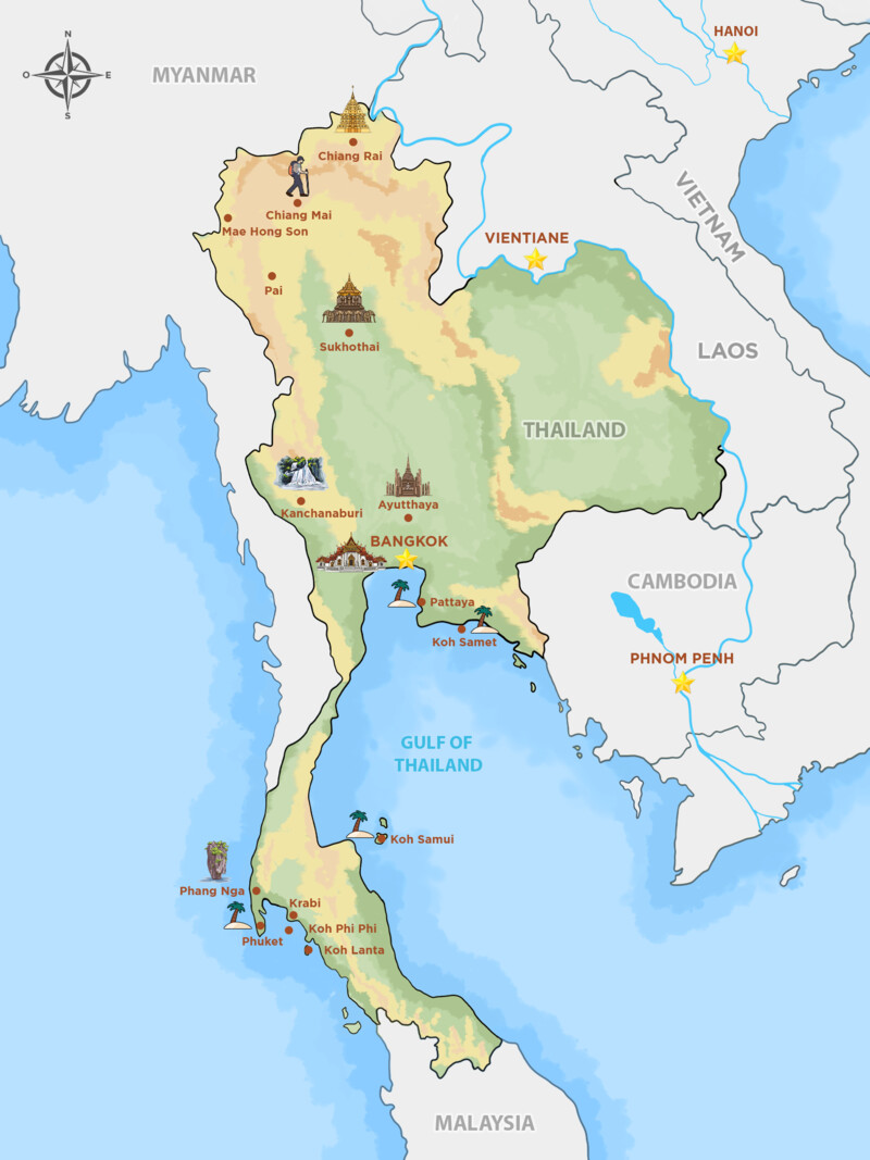
Planning a trip but confused by the geography? Download our one-page Thailand Tourist Map 2026 (PDF) in English. It marks 16 of the country's main destinations, from Chiang Rai, Pai and Mae Hong Son in the north to Phuket, Krabi, Koh Phi Phi and Koh Lanta in the south, with Bangkok, the Gulf of Thailand and the surrounding countries for orientation.
*Ready to print, or to save on your phone for offline use.
The printable map covers the classic route. For Isan and the smaller Gulf islands such as Koh Tao and Koh Phangan, use the regional maps further down this guide. A printed or offline map is best for the big picture: seeing which regions to combine and how far apart they are. For street-level navigation, download offline areas in a phone map app before you head into the mountains or out to the islands, where mobile signal can drop.
2. The Tourist Map of Thailand by Region
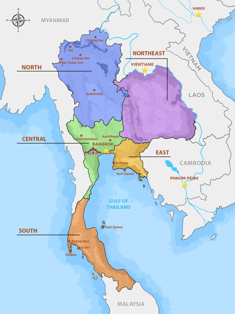
Thailand is larger than it looks on a screen: even the direct flight from Chiang Mai to Phuket takes about two hours. The easiest way to read a Thailand tourist map is to split it into five travel regions, each suited to a different kind of trip.
What Part of Thailand Is Best for Tourists?
For a first trip, combine three areas: Bangkok and the central plains for temples and history, the north around Chiang Mai for mountains and hill culture, and one southern coast for beaches, choosing the Andaman side (Phuket, Krabi) from November to April or the Gulf islands (Koh Samui) from January to August.
The table below works as a Thailand map with cities and islands in one view: where each region is, its main towns and airports, and how much time to give it.
Region
Main cities (airport)
Coast & islands
Best for
Suggested time
North
Chiang Mai (CNX), Chiang Rai (CEI), Pai, Mae Hong Son, Sukhothai
None, the region is inland
Temples in a cooler climate, mountains, hill-tribe villages, trekking
The Grand Palace, former royal capitals, WWII history, food
3 to 4 days
Northeast (Isan)
Udon Thani (UTH), Khon Kaen, Nakhon Ratchasima
None, the Mekong forms part of the border
Khao Yai National Park, Khmer-era temples, rural life, Isan food
3 to 5 days
East
Pattaya (U-Tapao, UTP), Chon Buri, Rayong
Koh Samet, Koh Chang
Short beach breaks close to Bangkok
2 to 3 days
South
Phuket (HKT), Krabi (KBV), Koh Samui (USM), Surat Thani (URT)
Andaman: Phi Phi, Lanta, Lipe. Gulf: Samui, Phangan, Tao
Beaches, island hopping, snorkeling and diving
4 to 7 days
Overview of Thailand Tourist Map
🚗 Thailand Travel Cheat Sheet: Distances & Travel Times
One of the biggest mistakes travelers make is underestimating the size of Thailand. Use this table to plan your logistics between major hubs:
Route
Distance (approx)
✈️ Flight Time
🚌 Bus/Train Time
Bangkok ➡ Ayutthaya
80 km
N/A
1.5 to 2 hours by road or train
Bangkok ➡ Kanchanaburi
130 km
N/A
2.5 to 3 hours by road
Bangkok ➡ Chiang Mai
700 km by road
1h 15m
11 to 13 hours on the overnight sleeper train from Krung Thep Aphiwat station
Chiang Mai ➡ Chiang Rai
190 km
N/A
About 3.5 hours by road
Chiang Mai ➡ Pai
130 km
N/A
About 3 hours by minivan (762 bends)
Bangkok ➡ Phuket
840 km
1h 25m
12 to 14 hours by bus (no railway to Phuket)
Bangkok ➡ Koh Samui
760 km, including the sea crossing
1h 10m
Train or bus to Surat Thani, then ferry: 10 to 12 hours
Chiang Mai ➡ Phuket
1,200 km in a straight line, far more by road
2 hours
Not practical by land (more than a day)
Krabi ➡ Koh Phi Phi
40 km (Sea)
N/A
Ferry: 1.5 to 2 hours
As a rule, any leg longer than a day's drive is worth a domestic flight, which leaves road and rail for shorter hops or for journeys that are part of the experience, such as the overnight sleeper to Chiang Mai.
3. Northern Thailand Tourist Map
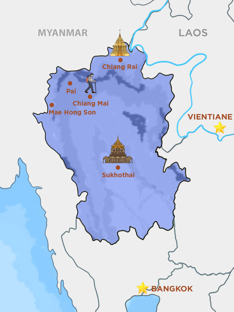
Northern Thailand is a region of forested mountains, river valleys and old Lanna towns. It is where travelers go for temples in a cooler climate, national parks, walks between hill-tribe villages and a slower pace, and it is only a short flight from Bangkok.
Map of Northern Thailand
Chiang Mai
Often called the "Capital of the North", Chiang Mai is the main transport hub for the whole region. From here, Pai is about three hours away by minivan on a winding mountain road, and Chiang Rai about three and a half hours by road.
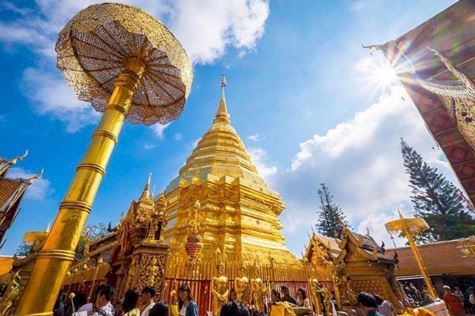
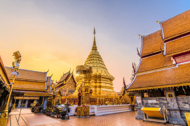
Temples of Wat Phrathat Doi Suthep
The old city, still ringed by its moat, holds dozens of temples, including Wat Phra Singh and the ruined chedi of Wat Chedi Luang, and the wider city counts several hundred. Wat Phra That Doi Suthep looks down on Chiang Mai from the mountain to the west, and Doi Inthanon National Park, home to Thailand's highest peak, is within day-trip range. Cooking classes, night markets and craft villages on the edge of town fill the rest of a stay.
Chiang Rai was the first capital of the Lanna kingdom, founded by King Mangrai in the 13th century before he moved his court to Chiang Mai. Most visitors now come for its modern temples and for the Golden Triangle, about an hour to the north, where Thailand, Laos and Myanmar meet on the Mekong River. The area was once one of the world's main opium-growing regions, a history told at the Hall of Opium museum.
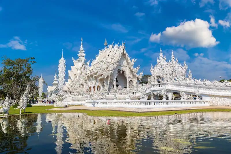
Chiang Rai itself is a quieter base than Chiang Mai. Its best-known sights are the White Temple (Wat Rong Khun) and the Blue Temple (Wat Rong Suea Ten), and the surrounding hills suit families who want mountain scenery and village visits without long drives.
White Temple in Chiang Rai
Sukhothai
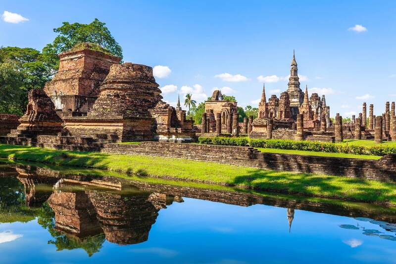
Sukhothai was the capital of the first Thai kingdom in the 13th century, and it sits between Bangkok and Chiang Mai, which makes it a natural stop on an overland route north. The heart of the old city is Sukhothai Historical Park, a green expanse of lotus ponds, brick chedis and large seated Buddhas, with Wat Mahathat at its center.
The ruins, partly restored, are listed as a UNESCO World Heritage Site and form one of the most important historical complexes in the country. Renting a bicycle is the easiest way to move between the temples, and an overnight stay lets you see them in the early-morning light before the day visitors arrive.
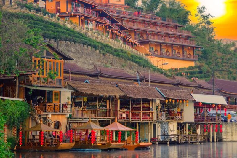
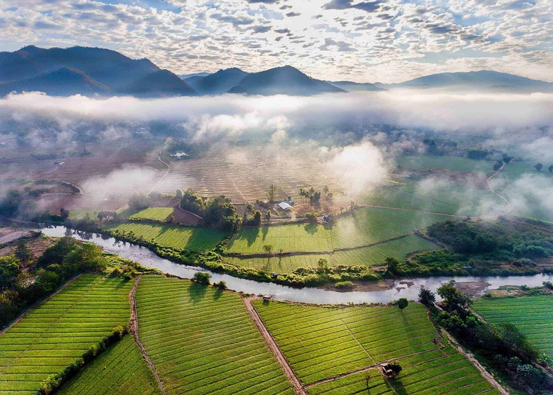
In the far northwest corner of the Thailand tourist map, Mae Hong Sonsits in a mountain valley close to the Myanmar border. It gives its name to the Mae Hong Son Loop, a road circuit of around 600 km that is often said to have 1,864 curves, popular with motorbike riders and self-drive travelers.
Mae Hong Son, a valley town in Thailand's far northwest
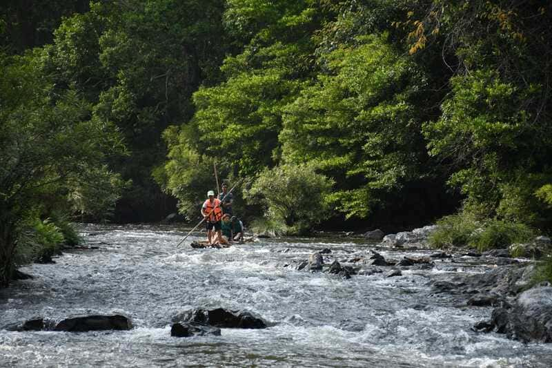
Most of the province is forested mountains. The town has Burmese-style (Shan) temples, hot springs close by and a slow, small-town rhythm, and it works well as a base for trekking and rafting.
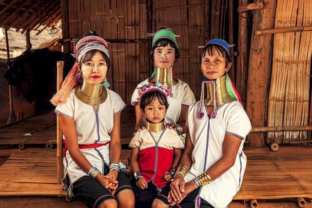
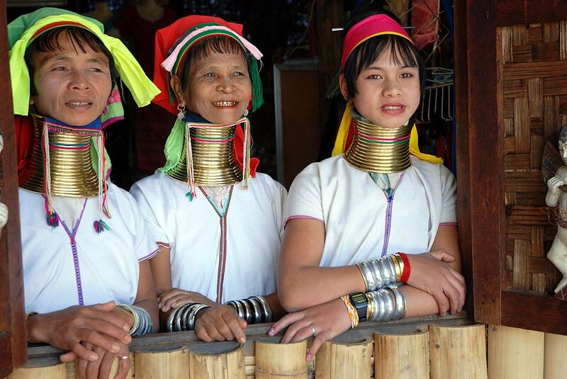
Several Kayan villages, where some women wear brass neck rings, are also in Mae Hong Son province. Many Kayan families came to Thailand as refugees from Myanmar and have limited access to Thai citizenship, and visits to these villages have long been debated. If you go, choose a village where people actually live rather than a roadside show village, buy crafts directly from the makers and ask before taking photos.
Kayan women wearing brass neck rings in northern Thailand
Pai
About 130 km from Chiang Mai, Pai is reached on a road known for its 762 bends, roughly three hours by minivan, so bring motion-sickness tablets if you need them.
Pai is a popular backpacker town with a relaxed pace, riverside guesthouses and an evening walking street. Rock climbing, camping and short treks are all close by, and the hot springs and Pai Canyon at sunset are the classic outings.
Pai, a mountain town for hiking, climbing and slow days
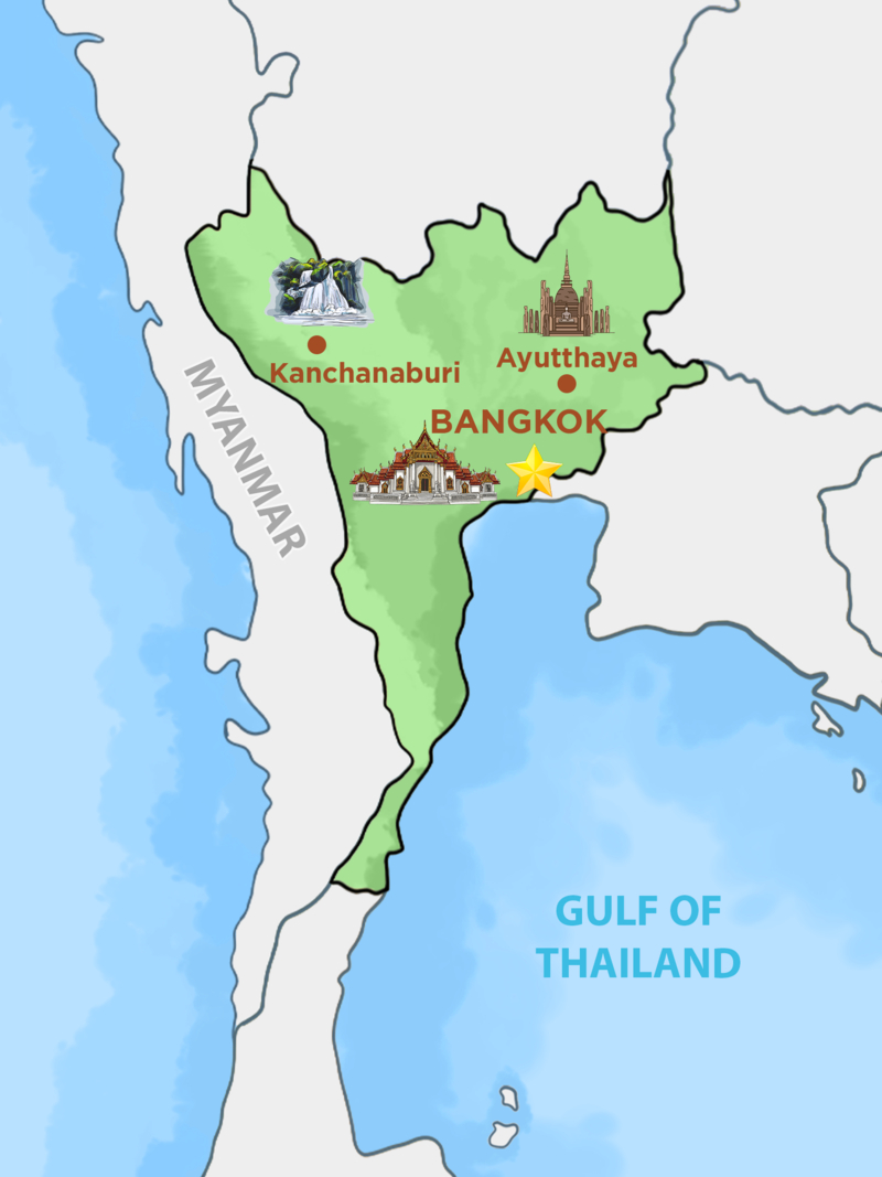
Central Thailand is the heart of the map: the flat, rice-growing plain of the Chao Phraya River, with Bangkok near its mouth. Two former royal capitals, the WWII sites of Kanchanaburi and quieter coastal towns all lie within a few hours of the city, which is why most trips start here.
Map of Central Thailand
Ayutthaya
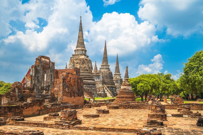
Located just 80km north of Bangkok (about 1.5 hours by road or rail), Ayutthaya is a strategic point on the map. Since it sits directly on the Northern Train Line, it makes an easy stopover on the railway journey to Chiang Mai, or a day trip from the capital.
Capital of the Siamese kingdom from 1351 until 1767 and a UNESCO World Heritage Site since 1991, Ayutthaya shows how powerful the city once was. Its red-brick ruins and toppled temples are spread across a river island, and a bicycle or a boat trip around the island is the best way to see them.
Located about 130km west of Bangkok (2.5 to 3 hours by road), Kanchanaburi is known worldwide for the Death Railway Bridge over the River Kwai, made famous by the film "The Bridge on the River Kwai". The bridge and the war cemeteries in town are a reminder of the prisoners of war and Asian laborers who built the line during World War II.
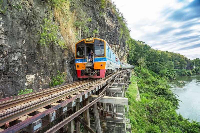
The Death Railway once ran for about 415 km, from Ban Pong in Thailand to Thanbyuzayat in Myanmar. Today, both tourists and locals ride the surviving section between Kanchanaburi and Nam Tok.
The train crosses the Khwae Yai River Bridge, runs through farmland and village stations, and edges along a cliff-side viaduct, where passengers lean out of the open windows for photos.
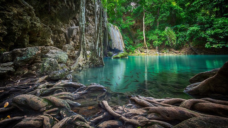
Erawan National Park, about an hour further out, is the other reason to stay a night. Its seven-tiered Erawan Waterfall has pools you can swim in, and the walk up to the top tier takes most of a morning.
Erawan Waterfall in Erawan National Park, Kanchanaburi
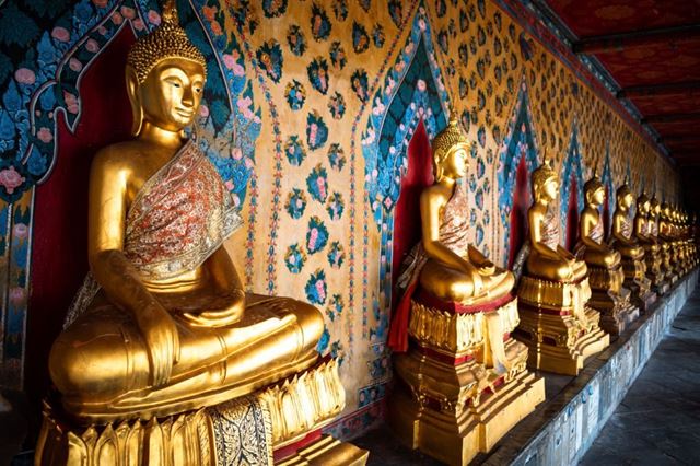
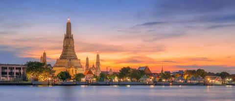
Bangkok, the capital of Thailand, spreads along the Chao Phraya River near the top of the Gulf of Thailand. For a first visit, the area to mark on your map is Rattanakosin, the old royal quarter, where the Grand Palace and Wat Pho stand within walking distance of each other and Wat Arun is a short ferry ride across the river.
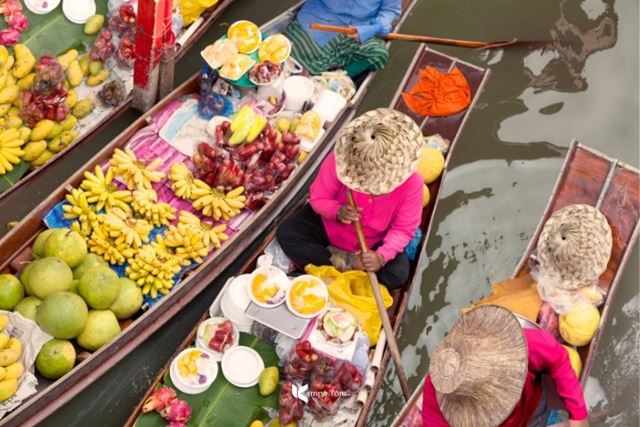
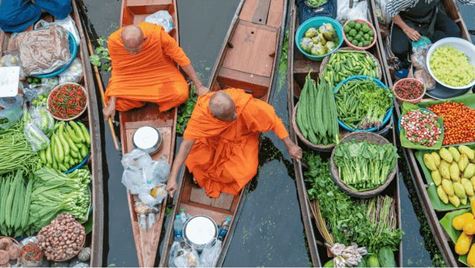
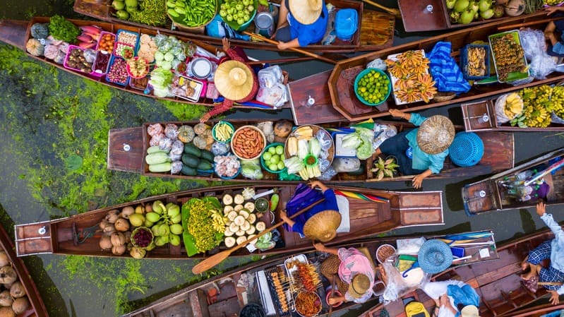
Bangkok's floating markets are a classic half-day trip. Damnoen Saduak, the best known, is about 1.5 to 2 hours southwest of the city, and it is at its liveliest early in the morning.
Floating markets in Bangkok
A boat on the Chao Phraya, either a sunset cruise or a night cruise past the lit-up temples, is one of the easiest ways to understand how the city is laid out. Bangkok is also a major shopping city, with malls such as ICONSIAM and CentralWorld, and its street food, from Chinatown to the local markets, is reason enough to plan at least two evenings here.
💦 News: Every year from 13 to 15 April, the Thai New Year turns the country into a giant water fight. Learn more about Songkran, Thailand's water festival
Phetchaburi lies about two hours southwest of Bangkok and is a quieter alternative to the beach towns further south. The province is home to Kaeng Krachan National Park, the largest in Thailand and part of a UNESCO-listed forest complex, where you can hike, camp, swim below waterfalls and look out over forested ridges.
Closer to town, the hilltop palace of Phra Nakhon Khiri, cave temples and the fishing villages around Cha-Am beach are all within easy reach. With its local food, temples and countryside, Phetchaburi works as a one-day excursion or a two-day break from the capital.
Kaeng Krachan National Park, the largest in Thailand, is in Phetchaburi
5. Isan, The Northeast Region Few Travelers Reach
Occupying the large northeastern section of the map, Isan (or Isaan) borders Laos along the Mekong and Cambodia to the south. Far fewer international travelers come here than to the north or the islands, yet it holds some of the country's most rewarding sights. Key places to pin on your map include Khao Yai National Park (part of a UNESCO-listed forest complex, with wild elephants, gibbons and hornbills) and the Red Lotus Sea in Udon Thani, which blooms roughly from December to February.
Life here is rural and moves at a slower pace. Isan cuisine, famous for som tum and sticky rice, is among the most popular in the country, and Khmer-era temples such as Phimai are the region's great historic sights. Some temples and viewpoints near the Cambodian border have been closed since the 2025 border conflict, so check current travel advice before planning a route along the frontier (see Where Not to Go in Thailand Right Now below).
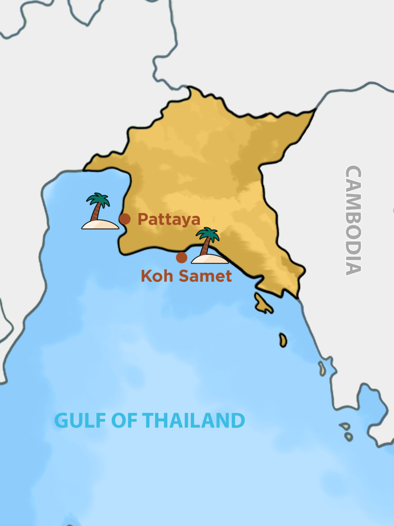
The east coast is the closest beach region to Bangkok. Koh Samet, Pattaya and the islands further east around Koh Chang are popular for short breaks, with forested headlands, sheltered bays and plenty of seafood.
Map of Eastern Thailand
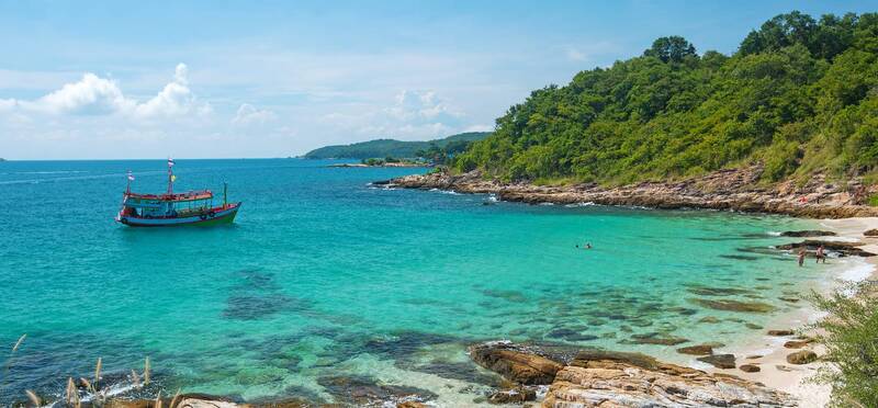
Koh Samet
About 200 km from Bangkok (roughly three hours to the pier) and 80 km from Pattaya, the 7 km-long island of Koh Samet is named after the Melaleuca tree, known as 'samet' in Thai. It is one of the easiest island escapes from the capital.
Sai Kaew Beach is the busiest, with water sports and restaurants, while Ao Prao on the west coast is known for its sunsets. Most of the island lies within Khao Laem Ya-Mu Ko Samet National Park, and trails link the beaches along the coast. Snorkeling trips run to the reefs around the smaller islands offshore.
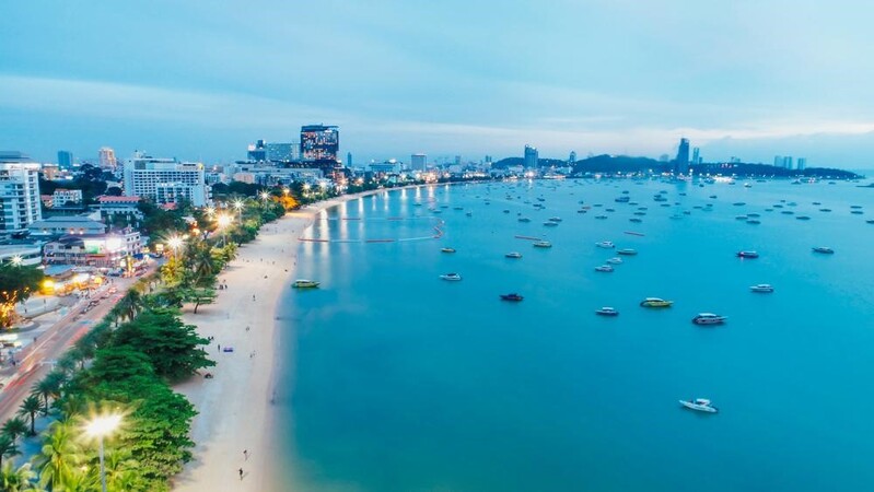
Chon Buri, about 80 km from Bangkok (around 1.5 hours by road), is known for its beaches, local cooking and fresh seafood. Pattaya, the province's best-known resort, combines a busy beach and nightlife with quieter sights such as the Sanctuary of Truth, a huge temple-like building carved entirely from wood, and day trips to the island of Koh Larn.
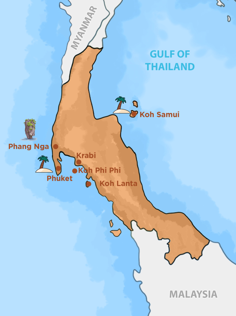
Southern Thailand is where most of the country's beaches and islands are, spread along a long peninsula with the Andaman Sea on one side and the Gulf of Thailand on the other. Limestone cliffs, coral reefs and long sandy bays make it the region for swimming, snorkeling, diving and island hopping.
Map of Southern Thailand
🏝️ The Island Dilemma: Andaman vs. Gulf Coast
Thailand's South has two coasts with opposite rainy seasons. Choosing the right side depends on when you travel and what kind of stay you want:
Criteria
Phuket (Andaman / West)
Koh Samui (Gulf / East)
Location
Andaman Sea (West Coast)
Gulf of Thailand (East Coast)
☀️ Best Time
November to April
(Rainy from about May to October)
January to August
(A good choice for July and August trips. Wettest from about October to December)
Vibe & Lifestyle
Busy, with nightlife and plenty of activities.
More relaxed, with a quieter island feel.
Budget
Wide range, from budget hostels to top-end resorts.
Wide range, from simple bungalows to private pool villas.
Nearby Trips
Phi Phi Islands, Similan, James Bond Island.
Koh Phangan (Full Moon Party), Koh Tao (Diving), Ang Thong Marine Park.
Getting There
Phuket International Airport (HKT), with direct flights from Bangkok and abroad.
Samui Airport (USM), or fly to Surat Thani and continue by ferry.
Krabi - Koh Phi Phi - Koh Lanta
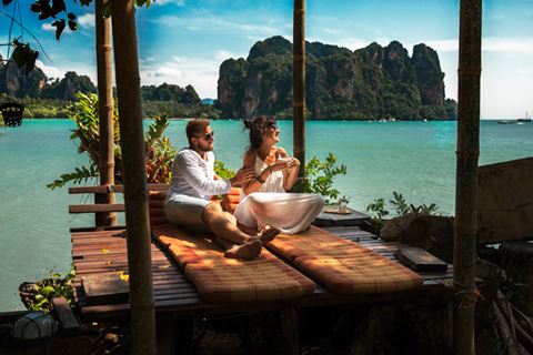
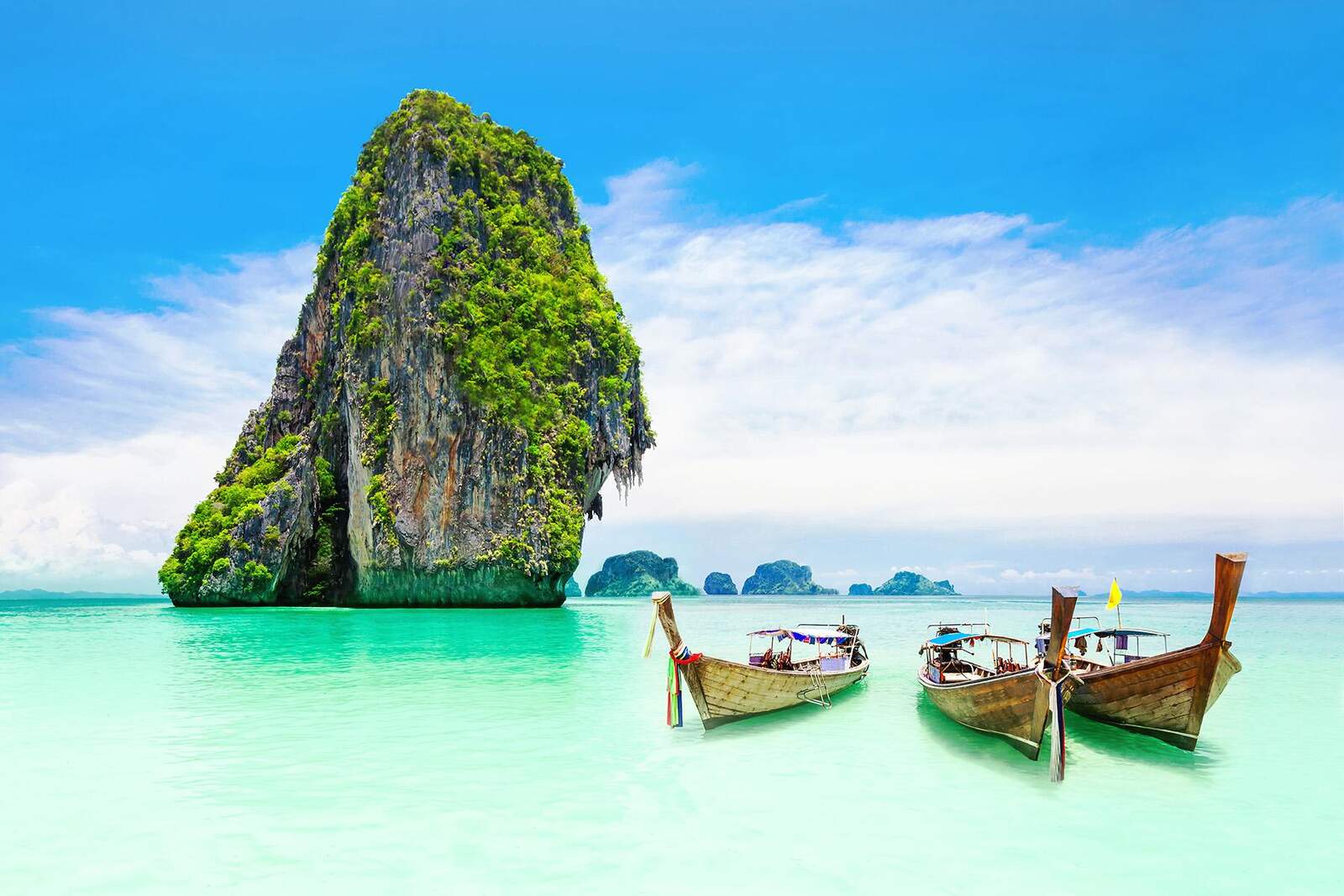
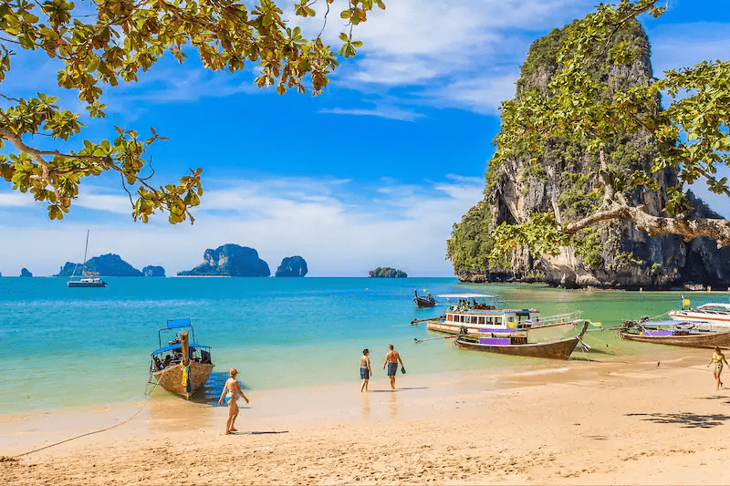
Krabi, a province on the Andaman coast, is known for limestone cliffs rising straight out of the sea. Its best-known beach, Railay, can only be reached by boat, and Ao Nang is the main base on the mainland.
Krabi's beaches have fine sand and clear water, framed by rocky islands just offshore. Mangrove forests, rock-climbing routes and hot springs inland add variety between beach days.
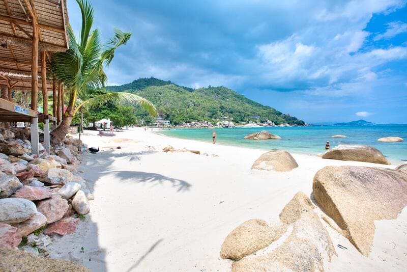
Krabi's sunny beaches
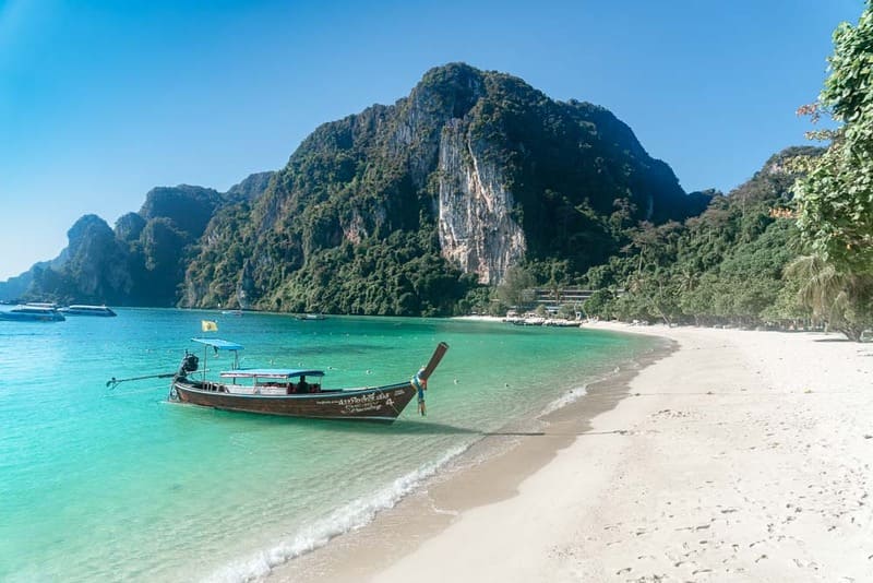
From Krabi Town, Koh Phi Phi is about 1.5 to 2 hours by ferry. Its coral reefs and turquoise water make it one of the main snorkeling and diving areas of the Andaman Sea. It is busy in high season, so an overnight stay lets you see it before the day-trip boats arrive and after they leave.
Koh Lanta, about two hours from Krabi by ferry or minivan, is calmer, with a string of long west-facing beaches. It is popular with families and suits travelers who want swimming, snorkeling and diving trips without the crowds of Phi Phi.
Koh Phi Phi is one of the main dive areas in Thailand
Phuket, on the Andaman coast, is Thailand's largest island and its busiest beach destination, with direct international flights, a wide choice of hotels and many smaller islands offshore.
Patong is the lively center, with most of the nightlife, while beaches such as Kata and Karon are calmer. Phuket Old Town, with its Sino-Portuguese shophouses and local restaurants, is worth half a day away from the sand.
Koh Phi Phi is about one to two hours away by boat, depending on the type of boat, and is the most popular day trip from Phuket.
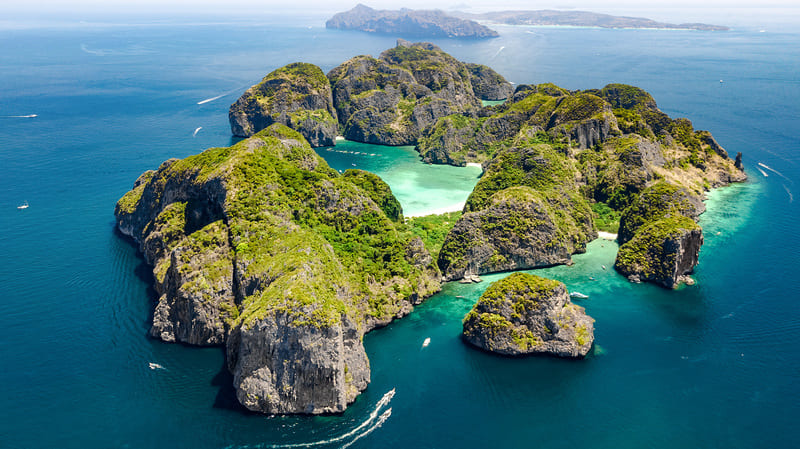
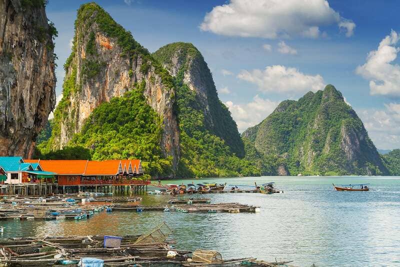
Phang Nga Bay, between Phuket Island and the mainland, is one of the most distinctive landscapes in Thailand. Dozens of limestone islands rise from shallow green water, many with sea caves and enclosed lagoons.
The bay mixes salt water and fresh water, with mangroves along its edges. The best way to see it is by sea kayak, paddling into the lagoons at low tide, and most boat trips stop at Khao Phing Kan, better known as James Bond Island.
Limestone islands in Phang Nga Bay
Koh Samui
As the second-largest island in Thailand after Phuket, Koh Samui is the main destination in the Gulf of Thailand. It has long beaches such as Chaweng and Lamai, forested hills inland and many resorts, and boat trips run to Ang Thong Marine Park. Koh Samui is also close to Koh Tao, known for learning to dive, and Koh Phangan, famous for its full moon parties.
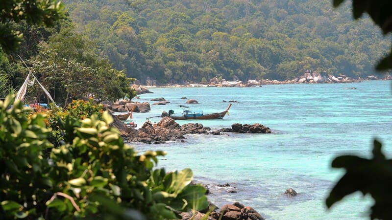
Koh Lipe sits at the southern end of the Andaman coast, next to Tarutao National Park and close to the maritime border with Malaysia. The island is small enough to cross on foot, with clear water and reefs close to the beaches. It gets busy in high season, and boats run mainly from Pak Bara pier on the mainland, with some seasonal services from Langkawi in Malaysia.
Koh Lipe, near Thailand's southern border with Malaysia
8. Suggested Thailand Itinerary
What Are the Top 3 Places to Visit in Thailand?
If you can only visit three places, make them Bangkok, Chiang Mai and one Andaman coast base such as Krabi or Phuket. Together they cover the capital's royal temples, the mountains and culture of the north, and the limestone islands of the south, all linked by direct flights of one to two hours.
When you use the map to plan a 10-day trip, pick two regions rather than five: Bangkok with the north, or Bangkok with one coast, and fly the long legs. Two to three weeks leave room for the central plain, the north and a beach, as in the route below.
Kampá Tour designs Thailand trips around history, culture, landscapes or time on the beach, and every route can be tailored to your pace. This 20-day itinerary is one example that follows the map from Bangkok through the central plain and the north to the Andaman coast:
Day 1: Bangkok - Arrival
Day 2: Bangkok - City Tour
Day 3: Bangkok - Damnoen Saduak Floating Markets - Bangkok
Day 4: Kanchanaburi - Bang Pa In - Ayutthaya
Day 5: Ayutthaya - Lopburi - Uthai Thani
Day 6: Uthai Thani - Sukhothai
Day 7: Sukhothai - Lampang
Day 8: Lampang - Chiang Mai
Day 9: Chiang Mai - City Tour
Day 10: Chiang Mai - Visit Camp Elephant
Day 11: Chiang Mai - Pai
Day 12: Pai - Mae Hong Son
Day 13: Mae Hong Son
Day 14: Mae Hong Son - Chiang Mai
Day 15: Chiang Mai - Krabi
Days 16 & 17: Krabi Free Time
Day 18: Krabi - Khao Lak
Day 19: Khao Lak
Day 20: Khao Lak - Phuket - Bangkok - Departure
Check out our latest ebook on Southeast Asia in winter and spring:
9. Essential Tips for Planning the Perfect Thailand Vacation
9.1 Best Time to Visit Thailand
Thailand can be visited all year, but the right months depend on which part of the map you choose.
Beaches and islands: the Andaman coast (Phuket, Krabi, Koh Phi Phi, Koh Lipe) is at its best from November to April, with dry, sunny weather around 28 to 32°C (82 to 90°F). The Gulf islands (Koh Samui, Koh Phangan, Koh Tao) follow a different pattern: they are best from January to August and wettest from about October to December.
Cities and culture: November to February is the coolest and driest time for Bangkok, Ayutthaya and Chiang Mai, with daytime temperatures around 25 to 30°C (77 to 86°F), which makes temple visits and walking far more comfortable.
Thailand changed its visa-free rules on 15 September 2026, replacing the old 60-day visa exemption. Travelers from about 60 countries and territories, including the United States, the United Kingdom, Canada and Australia, can now stay up to 30 days without a visa. That stay can usually be extended once, by 30 days, at a Thai immigration office for a fee of around 1,900 baht. A few nationalities receive a 15-day exemption or a visa on arrival instead.
Need a visa? If your country is not covered, apply for an e-Visa online at thaievisa.go.th.
🌍 Thailand Digital Arrival Card (TDAC):
All non-Thai travelers, including visa-exempt visitors, must complete the TDAC online within the 3 days (72 hours) before arrival, whether they arrive by air, land or sea. Apply only on the official site, https://tdac.immigration.go.th, where it is free, and submit a new card for every entry. Travelers who skip it have to fill it in at an airport kiosk, which slows down immigration.
👉 For more information about visas in Thailand: click here.
9.3 Where Not to Go in Thailand Right Now
As of September 2026, the areas to avoid are the Thailand-Cambodia border zone, where fighting flared in 2025 and land crossings are closed, and the deep-south provinces of Yala, Pattani and Narathiwat. Bangkok, Chiang Mai, Phuket, Krabi, Koh Samui and the other main tourist areas are well away from both.
How wide the border zone is depends on whose advice you read. Australia advises against travel within 10 km of the border in seven provinces from Sa Kaeo to mainland Trat, the United Kingdom advises against all but essential travel within 20 km, and Canada says to avoid all travel within 50 km. The United States rates Thailand Level 1 (exercise normal precautions) nationwide, with increased caution for the border and the three deep-south provinces. The UK also names parts of Songkhla province. If Koh Chang or Koh Kood in Trat province is on your list, check that your travel insurance covers it, and always read your own government's latest advice before booking.
9.4 Thailand's Currency
The currency is the Thai baht (THB). During 2026 it has traded between roughly 31 and 34 baht to 1 US dollar (about 33.4 in early August 2026), so check a live rate shortly before you travel. US dollars are not used for everyday payments.
Hotels, malls and larger restaurants take Visa and Mastercard, though some smaller businesses add a surcharge for card payments. Cash is still needed at markets, street stalls, small guesthouses and on many boats.
ATMs are everywhere in towns, but Thai banks charge foreign cards a flat fee of around 220 to 250 baht per withdrawal, on top of any fee from your own bank. Take out larger amounts less often, and always choose to be charged in baht rather than your home currency.
9.5 How to Get Around?
Moving around Thailand is straightforward, and you have plenty of options:
Flights: the fastest way to cover long distances, such as Bangkok to Chiang Mai, Phuket, Krabi or Koh Samui.
Trains: a comfortable, budget-friendly choice, especially the overnight sleeper train to Chiang Mai.
Buses & Minivans: cheap but slower, and useful for reaching national parks and ferry piers.
Ferries: essential for island hopping, for example to Koh Samui, Koh Phi Phi or Koh Lanta.
Taxis & Ride-hailing Apps: easy and affordable in cities, and apps show the price upfront.
Tuk-tuks: fun for short city rides, but agree on the fare before you set off.
Entry rules, travel advisories, exchange rates and ATM fees in this guide were last checked on 23 September 2026. They change often, so confirm them with official sources shortly before you travel.
Yes. Domestic flights link Bangkok with Chiang Mai, Phuket, Krabi and Koh Samui in roughly an hour to an hour and a half, trains run north to Chiang Mai and south towards Surat Thani, and buses and minivans reach most towns. Learn more about:How to get around Thailand?
10.2. What is the most beautiful part of Thailand?
History and culture: Central Region (Bangkok)
Mountain scenery: Northern Region (Chiang Mai, Chiang Rai)
Khmer ruins and traditional festivals: Northeastern Region (Isan)
Beaches and islands: Southern Region (Phuket, Krabi, Koh Samui)
Beaches and resorts: Eastern Region (Pattaya, Koh Chang)
Mountain and sea views: Western Region (Kanchanaburi, Hua Hin)
10.3. What neighboring countries can you visit from Thailand?
Laos: the easiest overland neighbor. Cross the Friendship Bridge from Nong Khai to Vientiane, or enter at Chiang Khong for the slow boat down the Mekong to Luang Prabang.
Cambodia: home to the Angkor temples near Siem Reap. As of September 2026, the land border with Thailand is closed, so fly from Bangkok to Siem Reap or Phnom Penh instead.
Malaysia: reachable by road, rail or a short flight across the southern border. Check travel advice for the southern border provinces before going overland.
Vietnam: Vietnam does not border Thailand, but direct flights from Bangkok to Hanoi or Ho Chi Minh City take around 1.5 to 2 hours. It pairs well with Thailand for its mix of busy cities, Ha Long Bay, mountains in the north and the Mekong Delta.
10.4. Is $50,000 enough for a Thailand trip?
Yes, by a wide margin for almost any holiday. A $50,000 budget covers long stays in top hotels, private guides and domestic flights with plenty to spare. With a generous budget, the money makes the biggest difference when spent on a private guide and driver, well-located hotels, fewer long transfers and a route that can shift around the weather. For typical daily costs, see How Much Does It Cost to Travel to Thailand?
10.5. Is Thailand a safe country?
Yes, for most travelers. As of July 2026, the US State Department rates Thailand Level 1 (exercise normal precautions) nationwide, with increased caution for the Thailand-Cambodia border and the provinces of Yala, Pattani and Narathiwat. The everyday risks for visitors are road safety, scams and petty theft. See Where Not to Go in Thailand Right Now above.
Thailand combines mountains, former royal capitals and islands on two seas, and the map shows why most trips work best when they focus on two or three regions. Use this Thailand map to decide where to go, then let the travel times guide how many nights each stop needs.
To make the journey easier and shape each itinerary around your preferences, we would be glad to help you create a tailor-made trip. Please feel free to contact us for a free consultation!
Planning your trip?
Save time and get expert advice for FREE!
✅ 15 years of local experience
✅ Save up to 40 hours of planning
✅ Travel stress-free from start to finish
Book your free consultation today!







 Our team
 Our team
 Our team
 Our team



![[col-img21] Grand Adventure Through Thailand in 3 Weeks](/pic/news/images/3-week-itinerary-thailand-tourist-map.png)



 Other
Other Add us as a preferred source